
Mapping God
Before leaving for Colorado I stumbled on this set of very interesting maps created for a course at Valpraiso University. They illustrate the distribution of religion in America. There are individual maps showing the percentage of residents in each county who belong to each of the 25 or so most popular religions, as well as some comprehensive maps such as the one below, which shows the leading church in each county of the country.
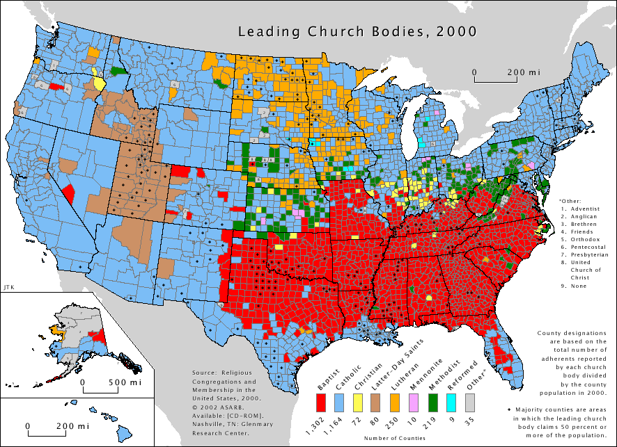
Blue is Catholic, red is Baptist. +2 celestial points
if you can guess brown.
posted by Cirrus of Malla @ 10:18 AM ⢠Permalink
0 comments
![]()


0 Comments:
Post a Comment
<< Home